
*Click on image for full-sized view.
Yes, that’s right. This photo was taken right in the middle of my hometown of New York City, one of the largest and most populated cities in the world.
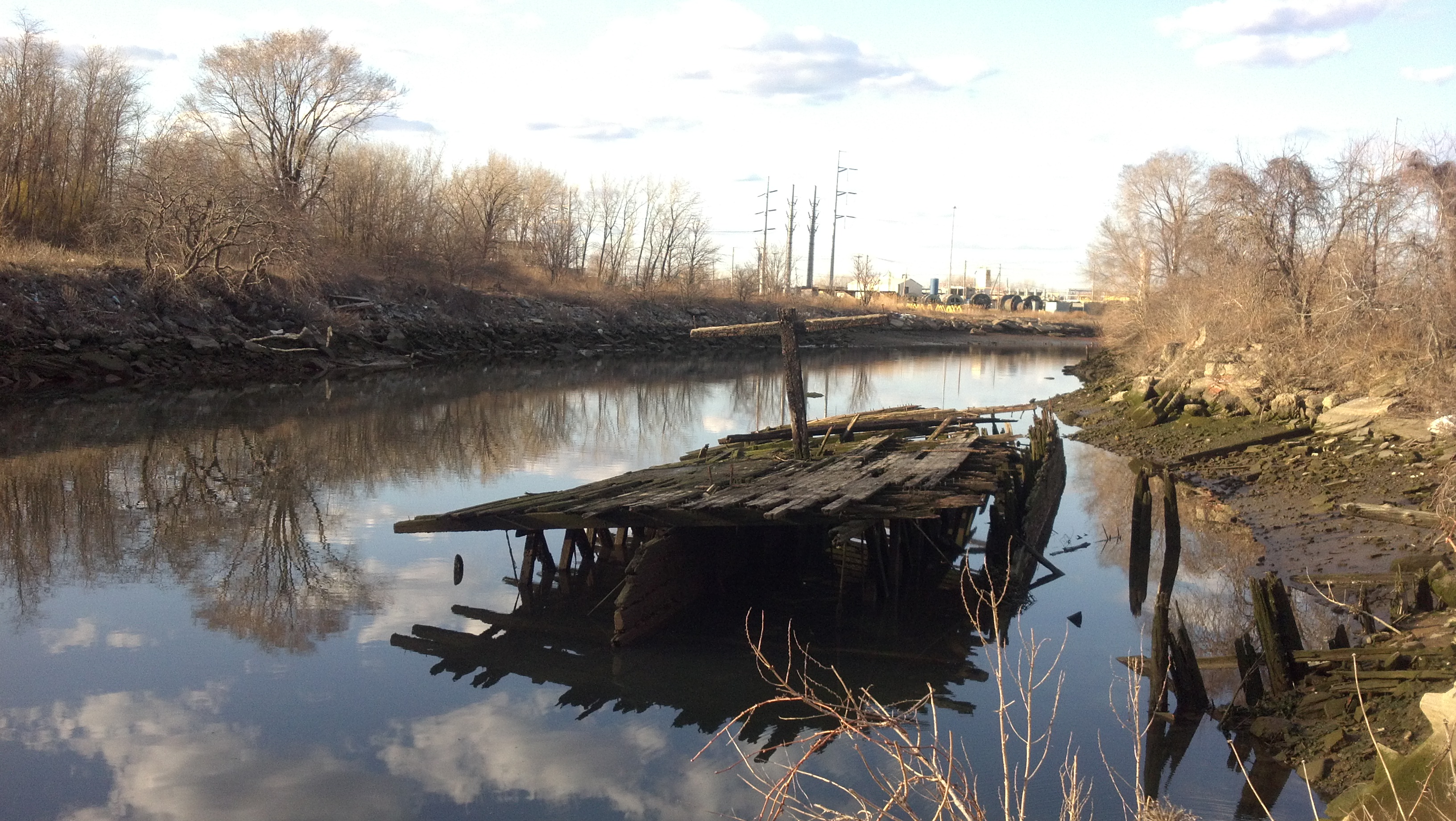
I was walking with my friend, Ariana, from a brewery, and we decided to stop at the end of 19th Avenue in Astoria, Queens, to relax. We had purchased some snacks and some beers, and we thought that this spot at the end of this little inlet was ideal.
This inlet was actually hard to research. No one today seems to know the name of it, and I finally happened across it from a map of the area (posted below) from 1896. In that map, it is called the Steinway Canal, named for the neighboring factory and headquarters of the world-renowned Steinway & Sons Pianos. It is located right across the Bowery Bay/East River from Rikers Island. Other more recent pages call it the Steinway Creek or Luyster Creek, located in the area that used to be all of Long Island City (LIC).
The place is a bit derelict and run down, but for me this adds to the beauty of it. At the southern end of this canal (this photo faces north), there is some factory where workers had music playing and were roasting a pig. Where we sat, just at the end of 19th Ave, it seemed like a shady area, as cars would drop off couples and drive by really slow; perhaps it was a good area to deal drugs or find paid companionship. Whatever the case, it is still one of the last remaining places that is somewhat undisturbed in a city that is constantly and rapidly changing and evolving.
Here’s a map from 1896 of LIC: 
Check out these two PDF docs for some neat newspaper article from almost a century ago describing the area and mentioning the Steinway Canal/Steinway Creek: